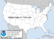
0709 pm cdt sat apr 14 2007
areas affected...srn/cntrl parts of al/ga and the fl pnhdl
concerning...tornado watch 142...143...
valid 150009z - 150215z
through 01-02z...the greatest supercell/tornado threat will exist
from far sern al into swrn and perhaps cntrl ga. elsewhere...the
severe weather threat for tornado watch 142...143...continues.
complex mcs is ongoing as of 2355z from nern ga swwd into srn al and
the wrn fl pnhdl with the most intense storms /hp supercells/ over
russell/barbour and coffee/dale counties in sern al. latest
mesoanalysis indicates that relatively strong pressure falls are
occurring ahead of these more intense storms over sern al with
latest ft. rucker showing a resultant increase in low-level shear
over the last hour. indeed...kinematic environment has become quite
favorable for tornadic supercells given the moist/unstable boundary
layer with 0-1 km srh of 300-350 m2/s2 and effective bulk shears of
55-60 kt.
despite the relatively complex nature of ongoing storms...potential
will exist for embedded long lived supercells capable of
tornadoes...some of which could be strong. this more favorable
environment appears to be bound by warm front /currently extending
from intersection with mcs near or s of csg esewd to off the sern ga
coast/ swd into warm sector over swrn ga where air mass remains
favorably moist and surface winds have maintained an ely component.
..mead.. 04/15/2007
Subscribe to:
Post Comments (Atom)








No comments:
Post a Comment