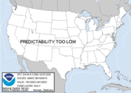
 Well, the SPC just issued a meso discussion that places me right in the middle of an upcoming severe thunderstorm watch. It looks like the dynamics are lining up for a DYNAMIC afternoon. The fog has dissipated almost completely, and the sky is actually showing some breaks allowing for the heating to break through.
 ISOLATED TORNADOES WILL STILL BE POSSIBLE...ESPECIALLY NEAR THE WARM FRONTAL BOUNDARY WHERE BACKED SURFACE FLOW WILL BE MORE SUPPORTIVE OF ROTATING UPDRAFTS. EXPECT THE STRONGEST ACTIVITY TO BE NEAR AND SOUTH OF THE WARM FRONTAL BOUNDARY WHERE INSTABILITY WILL BE MOST FAVORABLE.
 12:35 Update: There it is!
~Dew








No comments:
Post a Comment