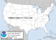
Today poses the greatest threat of severe weather in the South since last spring. There were at least 14 reports of tornadoes yesterday and two fatalities in the town of Paris, in Northeast Missouri. This morning the SPC edged the Moderate Risk area a little farther south into Tennesse, almost to North Alabama. A Public Severe weather Outlook has also been issued.
The Mobile NWS has issued numerous tornado warnings this morning for counties in southwestern Alabama and western Florida.
The SPC has now issued a new mesoscale discussion regarding the potential for supercell development from my location and points west. An excerpt...
MESOSCALE DISCUSSION 2108
NWS STORM PREDICTION CENTER NORMAN OK
1026 AM CDT THU OCT 18 2007
CONCERNING...SEVERE POTENTIAL...WATCH POSSIBLE
TRENDS ARE BEING CLOSELY MONITORED FOR AN
INCREASING SEVERE THREAT AND THE POSSIBILITY
OF ONE OR MORE WATCHES...PERHAPS BY EARLY
AFTERNOON.
...SEVERE THREAT WILL INCREASE CORRESPONDINGLY
WITHIN STRONG DEEP LAYER SHEAR FAVORABLE FOR
SUPERCELLS...BETWEEN STRONG SOUTHWESTERLY
POLAR AND SUBTROPICAL JET AXES. ALTHOUGH LOW-
LEVEL SHEAR MAY ONLY BE CHARACTERIZED BY WEAK
CLOCKWISE TURNING WITH HEIGHT...HODOGRAPHS
BENEATH 30-40 KT SOUTHWESTERLY 850 MB FLOW
WILL BE FAVORABLE FOR TORNADOES...WHICH COULD
BECOME STRONG.







No comments:
Post a Comment