Could we have the makings of an Atlantic hurricane?? All eyes are now on the Atlantic Ocean since Felix has moved on shore in Central America.
Computer models are in disagreement as to where/when this storm moves. As the famous James Spann at ABC 33/40 in Birmingham, Alabama said earlier today "There will be sleepless nights on the Atlantic coast from Charleston to Boston"...I think he is probably right!
At 5:30 pm this evening, I saw this from the Nat'l Hurricane Center:
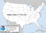
A NON-TROPICAL AREA OF LOW PRESSURE IS LOCATED ABOUT MIDWAY BETWEEN BERMUDA AND THE NORTHEAST FLORIDA COAST. THIS SYSTEM IS SLOWLY BECOMING BETTER ORGANIZED...AND WHILE UPPER-LEVEL WINDS ARE CURRENTLY ONLY MARGINALLY FAVORABLE IT HAS THE POTENTIAL TO BECOME A TROPICAL OR SUBTROPICAL CYCLONE OVER THE NEXT COUPLE OF DAYS AS IT MOVES SLOWLY AND ERRATICALLY.
Hmmmm, are they playing it safe??? Only time will tell.
Showing posts with label hurricanes. Show all posts
Showing posts with label hurricanes. Show all posts
Tuesday, September 4, 2007
Friday, August 17, 2007
Dean Update
Here is an excerpt from the text of the 1:45 p.m. special advisory on Dean. Air Force reconnaissance measured a flight level wind of 124 miles per hour.
BULLETIN
HURRICANE DEAN SPECIAL ADVISORY NUMBER 18
NWS TPC/NATIONAL HURRICANE CENTER MIAMI FL
AL042007145 PM AST FRI AUG 17 2007
…DEAN STRENGTHENS TO A MAJOR HURRICANE WITH 125 MPH WINDS…
A HURRICANE WARNING REMAINS IN EFFECT FOR MARTINIQUE…DOMINICA…AND GUADELOUPE AND ITS DEPENDENCIES. THE WARNING WILL LIKELY BEDISCONTINUED LATER TODAY.
AT 145 PM AST…1745Z…THE CENTER OF HURRICANE DEAN WAS LOCATEDNEAR LATITUDE 14.8 NORTH…LONGITUDE 63.6 WEST OR ABOUT 175 MILES…280 KM…WEST OF MARTINIQUE AND ABOUT 300 MILES…480 KM…SOUTHEAST OF SAN JUAN PUERTO RICO.
DEAN IS MOVING TOWARD THE WEST NEAR 22 MPH…35 KM/HR…AND THIS MOTION IS EXPECTED TO CONTINUE. ON THIS TRACK…DEAN WILL MOVEACROSS THE EASTERN CARIBBEAN SEA TODAY.
SATELLITE IMAGES AND DATA FROM AN AIR FORCE RECONNAISSANCE PLANEINDICATE THAT DEAN HAS STRENGTHENED. THE MAXIMUM SUSTAINED WINDSARE NOW 125 MPH…205 KM/HR…WITH HIGHER GUSTS. DEAN IS A MAJOR CATEGORY THREE HURRICANE ON THE SAFFIR-SIMPSON HURRICANE SCALE. ADDITIONAL STRENGTHENING IS FORECAST DURING THE NEXT 24 HOURS.
HURRICANE FORCE WINDS EXTEND OUTWARD UP TO 25 MILES…35 KM…FROMTHE CENTER…AND TROPICAL STORM FORCE WINDS EXTEND OUTWARD UP TO 185MILES…295 KM. BANDS OF HEAVY SQUALLS ARE STILL AFFECTING PORTIONS OF THE LESSER ANTILLES AND ARE APPROACHING PUERTO RICO AND THE U.S.AND BRITISH VIRGIN ISLANDS.
$$FORECASTER AVILA/MAINELLI
Monday, August 13, 2007
Looking ahead to Dean

I have no doubt in my mind that as I write this Dean is becoming a tropical depression. Within days we will have a major hurricane traversing the Atlantic on its way toward the Caribbean.
Where will it end up? No one knows, but now the GFS is placing it on the northern Mexican coast late next week. It looks like the GFS keeps our heat bubble ridge in place and shunts the storm to the west.
It is way too early to tell but there is no doubt that we will have lots to watch and talk about over the next two weeks!
Tuesday, May 22, 2007
New research findings on hurricane intensification

From NASA
Very interesting new reasearch from NASA shows that humid parcels of air from inside the eye of hurricanes sometimes intermingle with the eyewall, contributing to the formation of "hot towers". These factors contribute to the intensification of hurricanes.
Read more and watch animation here.
Subscribe to:
Posts (Atom)


